Routing
The Routing map tool allows you to add locations to the map and then navigate to those locations. Points along your route are tracked with letters, for example, point A, point B, and so on, with the Total Distance and Total Time to get from point to point displayed. Turn-by-turn directions are given, and the path is highlighted on the map. Hover over any direction to see the step highlighted on the map if you are using a mouse.
 NOTE: Esri has a limitation of 150 stops, so the Routing tool only allows 150 stops along the route.
|
 PREREQUISITES: PREREQUISITES:
- Organizations must have an ArcGIS.com organizational account.
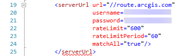
- If you are not using Single Sign-on (SSO), ArcGIS Online credentials and a portion of the URL (//route.arcgis.com) must be added as a record in your Esri Resource Proxy. See Add a Resource Proxy in the Designer for 15.8 Guide for more information.
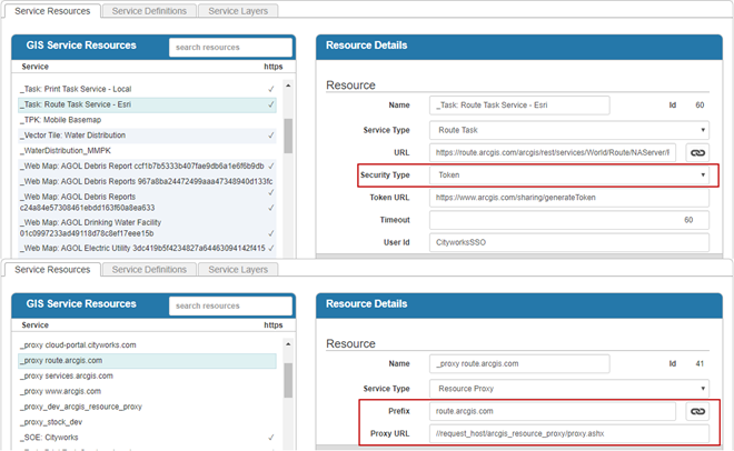
- The route service must be added as a service resource along with an additional record for the resource proxy in Designer under GIS > Services, and those service resource entries must be added to the service definition that your user corresponds to. See Add or Edit GIS Service Resources in the Designer for 15.8 Guide for more information.
|